
See Your Property with Unprecedented Clarity
Sky Hunter TX’s drone-based ranch mapping services provide high-resolution aerial imagery, accurate topographical data, and detailed land insights—empowering you to make strategic, well-informed management decisions.
Precision Ranch Mapping
A clear, up-to-date map is a powerful tool for ranch owners, managers, and real estate professionals. With Sky Hunter TX’s ranch mapping services, you gain more than just a bird’s-eye view—you receive an accurate, actionable blueprint of your property’s layout and resources. Whether you’re planning new infrastructure, evaluating water distribution, or enhancing wildlife habitat, our detailed maps ensure you understand every acre of your land.
How It Works
Initial Consultation
We discuss your mapping objectives—such as identifying property boundaries, locating improvements, planning new fencing, or enhancing pasture rotations.
Precision Drone Flights
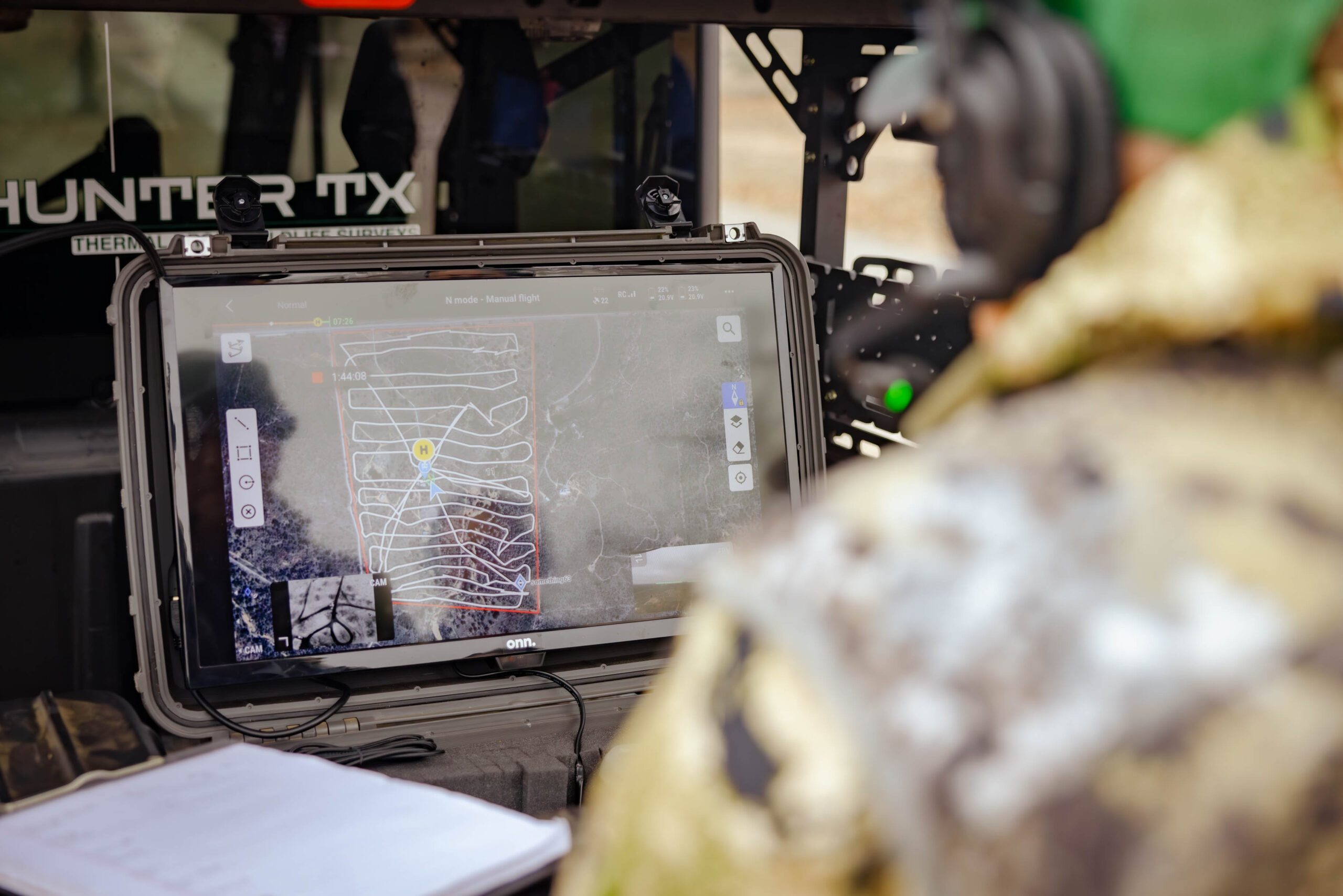
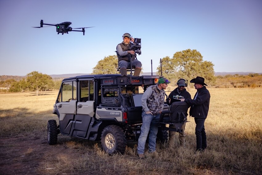
Our FAA-licensed pilots conduct aerial surveys using high-resolution imaging and GIS (Geographic Information System) technology.
Data Analysis & Layering
We process collected data to create rich, layered maps, integrating terrain elevations, vegetation types, water sources, and infrastructural elements.
Detailed Reporting & Deliverables
You receive digital maps, imagery, and data sets formatted for easy reference and seamless integration into your planning and management processes.
Why Choose Sky Hunter TX for Ranch Mapping?
- High-Resolution Aerial Imagery: See every detail of your property, from fence lines to feeder locations, in crystal-clear quality.
- Accurate Geospatial Data: Our advanced mapping tools ensure that measurements, property boundaries, and coordinates are precise and reliable.
- Customizable Outputs: Request specialized layers, annotations, or overlays that address your unique operational needs.
- Strategic Planning Made Easy: Access maps that inform better land use, infrastructure placement, water management, and wildlife habitat enhancement.
Who Benefits from Our Ranch Mapping Services?
- Ranch Owners & Managers: Optimize resource allocation, plan improvements, and manage infrastructure more efficiently.
- Real Estate Professionals & Investors: Present potential buyers with a clear, professional visual of property boundaries, features, and assets.
- Wildlife & Land Managers: Identify habitat opportunities, monitor land health, and make informed decisions that support biodiversity and game quality.
Case Study
“After receiving our ranch maps from Sky Hunter TX, we were able to pinpoint exactly where to place new water troughs and adjust fencing for better grazing rotation. The clarity and detail saved us time, money, and guesswork.”
Kelly D.
West Texas Ranch Owner
Ready to Get the Full Picture of Your Land?
Unlock deeper insights and make data-driven decisions with comprehensive ranch mapping services. Contact Us Today to schedule a mapping consultation and discover how we can help you visualize your property’s true potential.
Ranch Mapping FAQs
What is Ranch Mapping, and why is it important in Texas?
Ranch Mapping involves creating high-resolution aerial imagery and GIS-based maps of your property’s fences, roads, water sources, vegetation types, and topography. In Texas—where ranches can span thousands of acres and terrain can vary widely—accurate mapping is vital for efficient property management, wildlife planning, and infrastructure development.
Do I need any special permits from TPWD or local authorities to map my ranch?
Generally, no. TPWD doesn’t require a permit solely for aerial mapping on private land. However, commercial drone operators must hold a valid FAA Part 107 certification. As long as you’re not disturbing or harassing wildlife, TPWD does not impose additional mapping restrictions.
How does ranch mapping help with wildlife management and TPWD programs like MLDP?
Detailed maps help you pinpoint critical habitats, feeding zones, water sources, and travel corridors that deer and other wildlife use. This knowledge is particularly valuable if you’re enrolled in the Managed Lands Deer Program (MLDP) or 1-D-1 Wildlife Valuation, as accurate documentation of habitat features can strengthen your compliance reports and demonstrate sound land stewardship to TPWD or your county appraisal district.
Can mapping reveal property boundary issues or fence encroachments?
Absolutely. High-resolution drone imagery and GIS overlays can confirm whether fences align with official property boundaries and identify any encroachments. Early detection of fence or boundary discrepancies helps you address them proactively, avoiding disputes or costly legal matters down the road.
Does ranch mapping help with water resource planning in Texas?
Yes. In a state prone to drought and variable rainfall, knowing the layout of ponds, creeks, and other water resources is essential. Our maps highlight existing water features and can help identify potential sites for additional stock tanks or water troughs—improving habitat for wildlife and livestock resilience.
Is there a best time of year to conduct ranch mapping?
While we can capture aerial data year-round, certain seasons offer better visibility. Many Texas landowners choose late winter or early spring, when foliage is thinner and water levels are more apparent. This timing can also coincide with habitat assessments or pre-season wildlife surveys, creating a more holistic view of your property.
Will ranch mapping disturb my livestock or wildlife?
Not significantly. Drone flights are relatively unobtrusive, especially at safe operating altitudes. Compared to ground crews traversing large pastures, drone mapping often causes minimal disturbance, aligning with TPWD’s preference for low-impact survey and management methods.
Do you provide a formal report or just raw imagery?
We deliver comprehensive, user-friendly data sets, including high-resolution orthomosaic (stitched-together) maps, topographical overlays, property boundary lines, and any relevant annotations (e.g., locations of feeders, gates, water sources). You’ll also receive easy-to-read PDF or GIS-compatible files that integrate with popular land management or mapping software.
How does ranch mapping impact my property value or potential resale?
Quality mapping showcases your land’s infrastructure, habitat, and potential improvements—making the property more attractive to prospective buyers, lessees, or investors. It highlights the care you’ve put into sustainable land use and accurate records, which can justify higher asking prices or more favorable lease terms.
Can I combine ranch mapping with other services, like wildlife surveys or habitat assessments?
Absolutely. Many Texas landowners bundle mapping with thermal wildlife surveys, feral hog detection, or habitat assessments to build a full picture of their ranch’s natural resources and infrastructure. This holistic approach supports comprehensive management plans, helps meet TPWD program requirements, and provides a clear roadmap for future improvements.